Clouds increase tonight with rain to follow
SEATTLE - Who is ready for a brief cool down? Ready for a few light showers too? That's our big weather story tonight! Rain returns overnight into Thursday for a quick visit and then it's back to summer sunshine for the area.
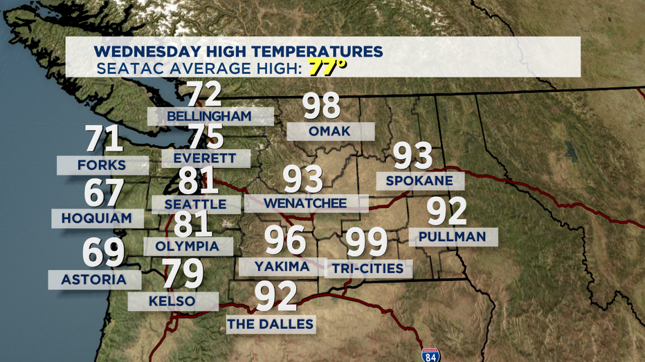
Today's highs jumping up above normal again today. The metro area saw a high of 81 while others to the north were slightly cooler in the mid to upper 70s. Eastern WA dealing with the summer heat again too today with nearly triple digits for Richland. Folks east will see a cool down as well. Please be mindful of the high fire danger for Central WA.
Here's a look at Wednesday's numbers.
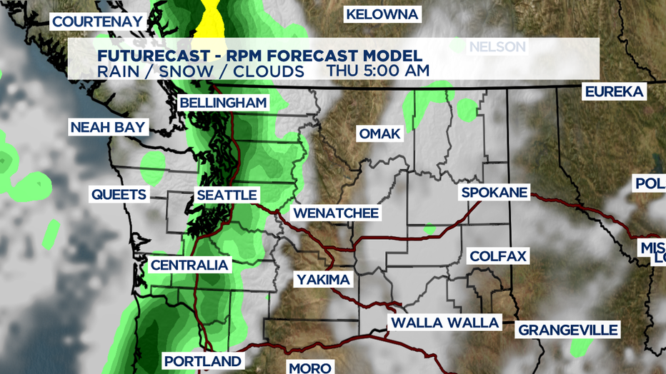
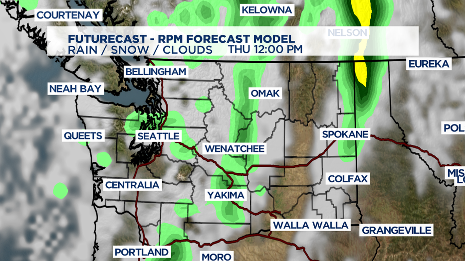
Rain will stream in overnight and hang with us through midday Thursday. By lunchtime, showers should taper off with some lingering showers over the Cascades through about dinner time. Clouds will decrease by late afternoon giving way to a little sunshine but don't worry if you are a fan of our summer blue skies, they will return as we sail into the weekend!
A weak trough will keep us a little cooler for Friday and Saturday. Look for partly cloudy to mostly sunny conditions with highs landing in the mid-70s, slightly below average.
The second half of the weekend high pressure starts to strengthen giving way to warmer highs and sunny skies. By Monday temps will climb back to near 80 again.
Tuesday and Wednesday will feature an increase in onshore flow as another upper trough moves into the north spreading a little more morning/overnight cloud cover. Highs will sit in the mid-70s.
Have a great night all!
- Erin Mayovsky, Q13 Forecaster
_____________________________________________________________________
Twitter: @ErinMayovsky
FB: /ErinMayovsky
Instagram: @ErinMayovsky
_____________________________________________________________________