

Chilly and sunny before stormy Friday
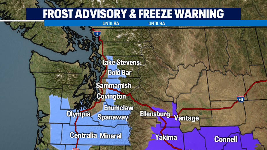
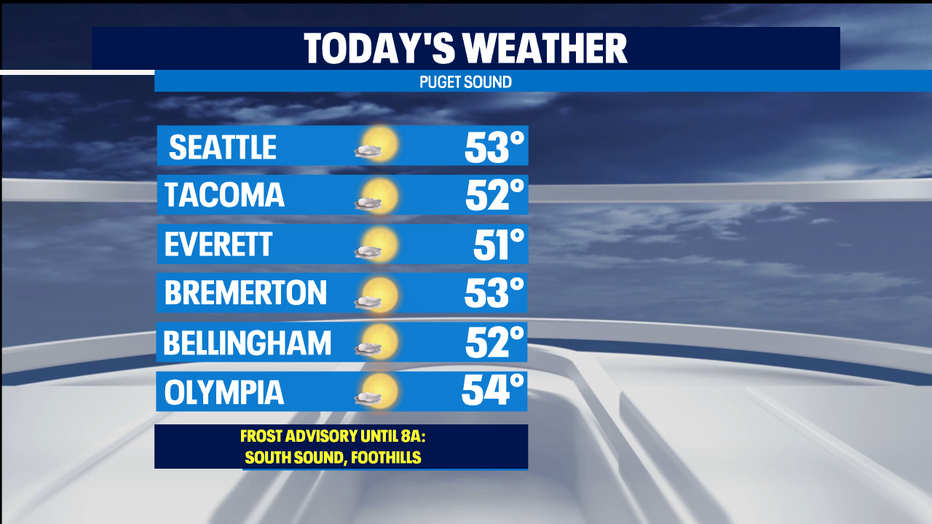
SEATTLE - A very cold morning around the Northwest - lots of spots in the South Sound, near Port Townsend, and foothills seeing some upper 20s and low 30s. Those areas at or below freezing are under a Frost Advisory until 8 a.m.
The eastern side of the Cascades is under a Freeze Warning until 9 a.m. You'll want to cover sensitive plants, including hanging baskets, and patio containers that are exposed to the cold air on all sides.
We're tracking some areas of fog, particularly in the South Sound where we're seeing visibility less than a quarter mile. Fog lifts and evaporates today for some gorgeous autumn sunshine. High temps only in the low 50s today. Normal is now 57 degrees.
Tomorrow our next weather system arrives. Rain drops arrive during the morning commute and it will stay with us most of the day. Areas on the Kitsap Peninsula could end up being in the rain shadow, but elsewhere it looks quite soggy. All this lowland rain will be mountain snow for ALL of our mountain passes. Accumulating snow will make for difficult travel. The calendar might say October, but it will be full-on winter in the Casacdes. Be prepared for winter driving conditions.
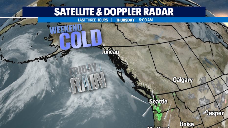
Once the front blasts through Friday night, some of the coldest air of the season will hit the NW. We'll see overnight lows near freezing for several days. Afternoon highs will struggle to get above the mid 40s this weekend. Cold air is drier air-- so we'll see some really nice weekend sunshine. Dry enough to get fall leaves raked up, winter garden preps, or that corn maze and pumpkin patch visit will be fun if you're dressed for the chilly temps.
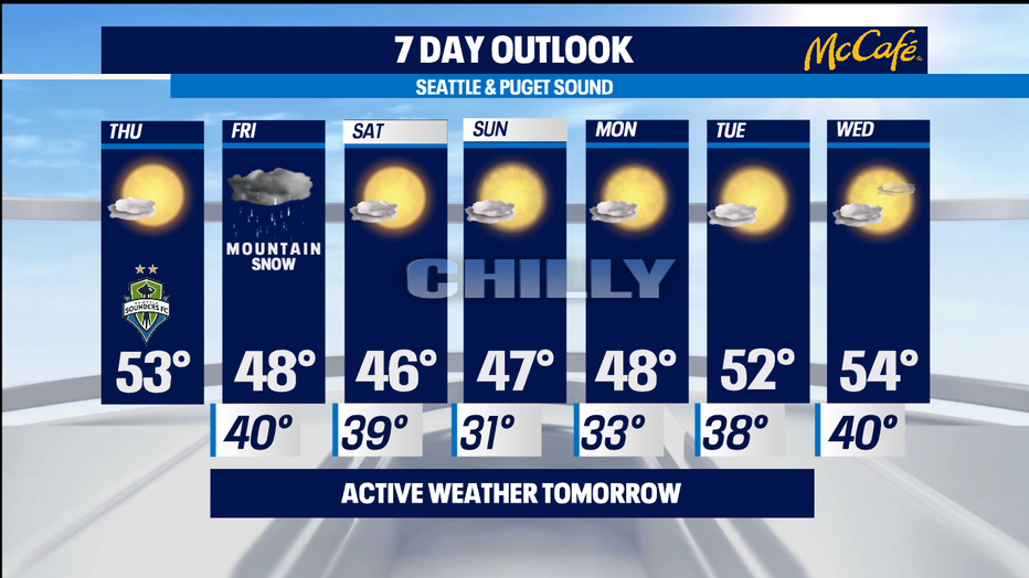
At this point, it looks like we'll see our overnight lows moderate back to seasonal norms in the 40s by the middle of next week without incident. -Tim Joyce