

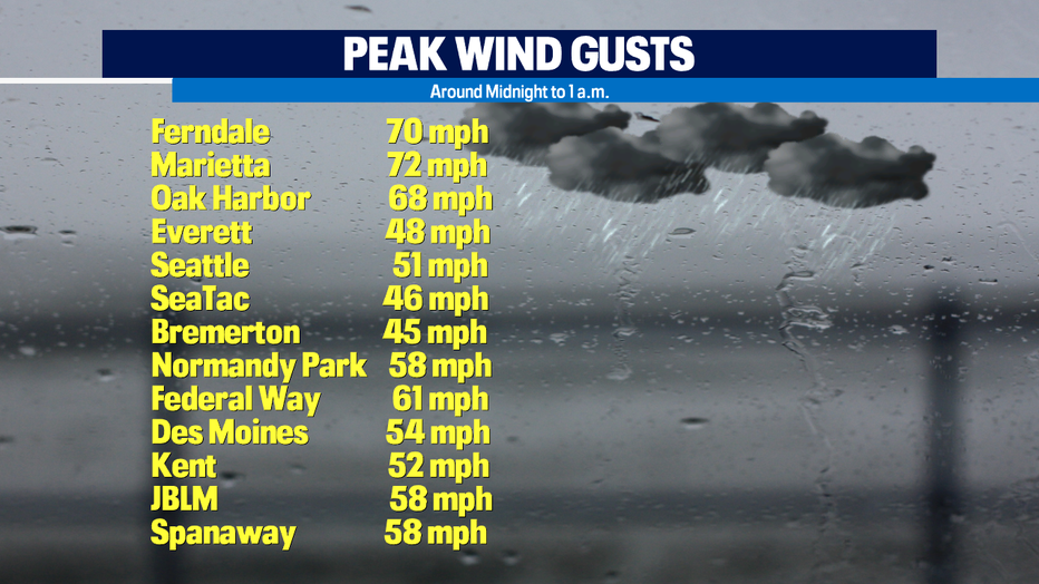
Calming down after severe wind storm overnight
Winds are calming down after last night's wind storm. The peak gusts happened around midnight to 1 a.m. Here is a list of some of the peak gusts. This goes from north to south. It's no wonder that with winds like these and our super saturated soils, we're seeing many trees down and lots of power outages.
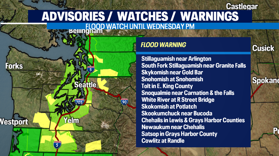
An atmospheric river, or Pineapple Express, slammed us yesterday with heavy rain, including a record-breaking one-day rain total at SeaTac of 2.33 inches. We had warm temps, topping out at 57 at SeaTac AND a record-tying 56 in Olympia. The result of this was a high snow level in the mountains where rain and snow melt careened down the slopes into our rivers. This is a list of the rivers at FLOOD STAGE this morning, from north to south. The rivers will recede today and tomorrow as we dry up and get colder today - so precip in the mountains comes down as snow and stays in the mountains where it belongs.
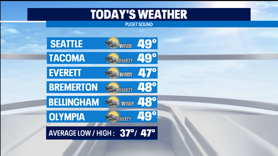
TODAY, rain is tapering off and winds are calming down. We'll be cooler, closer to normal, with highs in the upper 40s.
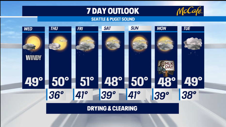
TOMORROW will be dry and calm, with highs around 50.
FRIDAY will start out with some rain, but it dries up quickly. Highs around 50.
The Martin Luther King Weekend looks pleasant for January -- mostly cloudy, mostly dry expect for a little rain on Sunday, and highs around 50.
Finally, we could all use a Box of Fun! Here's puppy Lucille on this Damp Paws Day!

Meterologist M.J. McDermott