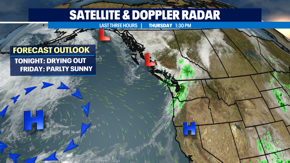
Brighter days ahead as showers decrease overnight with drier conditions over the weekend.
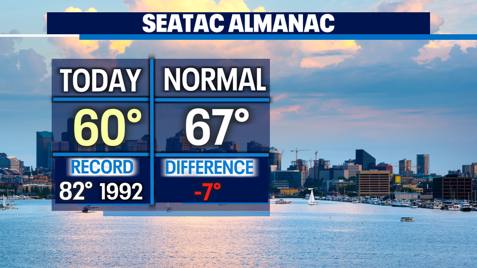
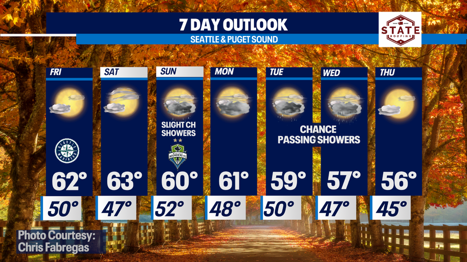
Seattle - Happy Wednesday! A cool Fall day as yesterday's storm is on its way out! Highs only landing again in the upper 50s to low 60s.
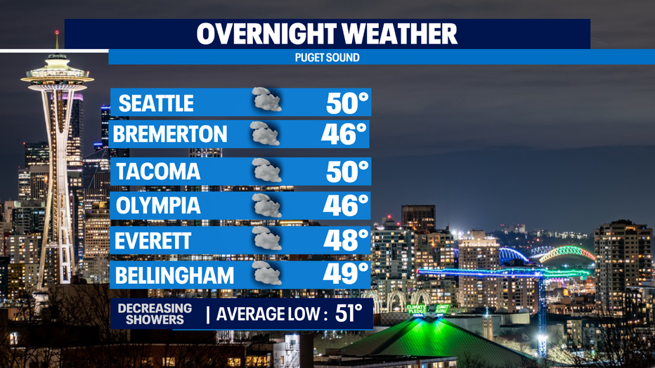
We'll continue to dry out into the overnight hours with temperatures in the upper 40s to low 50s. Tomorrow starts a new month and that means "Fog-Tober" is back! Some of us, especially in the SW Sound and near the Coast with see some patchy fog.
A small ridge of high pressure takes over tomorrow delivering mostly to partly sunny skies through the first part of the weekend. Highs will stay below average only topping out in the low to mid 60s.
The ridge will start to flatten out and that means clouds will increase late Saturday into Sunday as a few disturbances brush by the area. This brings a slight chance for light showers Sunday morning, mainly for the SW portion of the state.
The start of the first full week of October brings a mix between passing showers and sunshine. Highs will cool off even more in the upper 50s towards the end of the week. Brr!
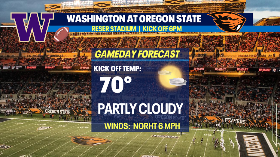
The Huskies hit the road for Corvallis taking on Oregon State Saturday. Kick off set for 6pm from Reser Stadium under partly cloudy skies with temps near 70.
Happy Fall everyone! Enjoy the weekend! ~Erin Mayovsky, FOX13 Forecaster
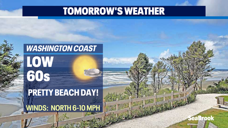
*Beach Forecast
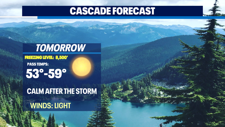
*Mountain Forecast
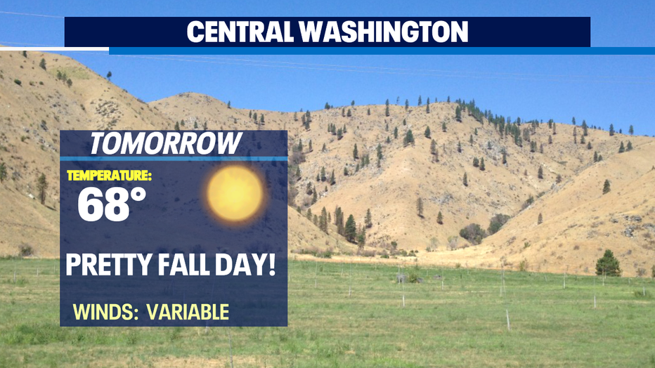
*Central WA Forecast