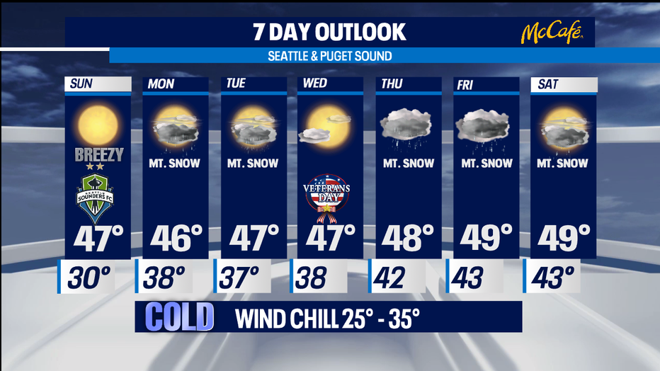
Brace for a bitter cold Sunday with northerlies delivering a fierce wind chill.
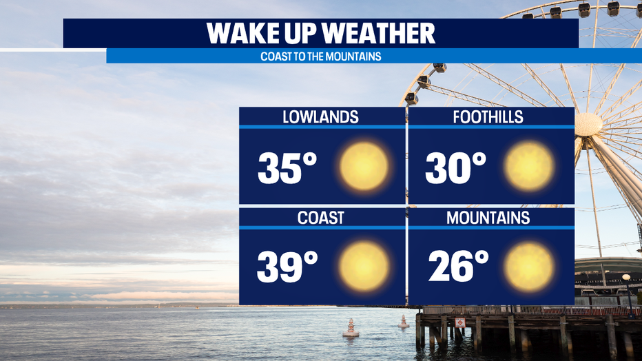
SEATTLE - Get ready for very chilly wake up temperatures across the state! Northerly winds, gusting out of British Columbia, will put a big chill factor on our highs Sunday. Our morning temps will range from the low to upper up 30's at the coast, mid 30s inland and only the upper 20s in the mountains, but add the wind element and it will "feel like" everyone is in the 20s. Brr! Bundle up tomorrow. The good news, we'll see plenty of sunshine! Highs around Western WA. will land below the norm, in the mid 40s.
Monday starts out the same way as Sunday, but then change comes by late afternoon. The next system pushing in rain and mountain snow. Tuesday rain continues with snow in the high country. Snow levels will drop to near 1,500'. Highs land in the mid 40s and will stay near those temps throughout the week.
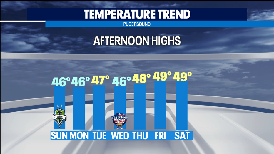
Veteran's Day we'll be a break in between systems. Look for mostly cloudy skies with a few weather makers for the end of the week delivering more rain and mountain snow. NW ski resorts will begin to build some ground on their bases.
Have a great night! ~Erin
_________________________________________________
- Erin Mayovsky, Q13 Forecaster
Twitter: @ErinMayovsky
FB: /ErinMayovsky
Instagram: @ErinMayovsky
_________________________________________________