

Seattle weather: Blistering highs Thursday, big cooldown Friday
SEATTLE - We're tracking one more hot afternoon this week before a big cooldown arrives Friday.
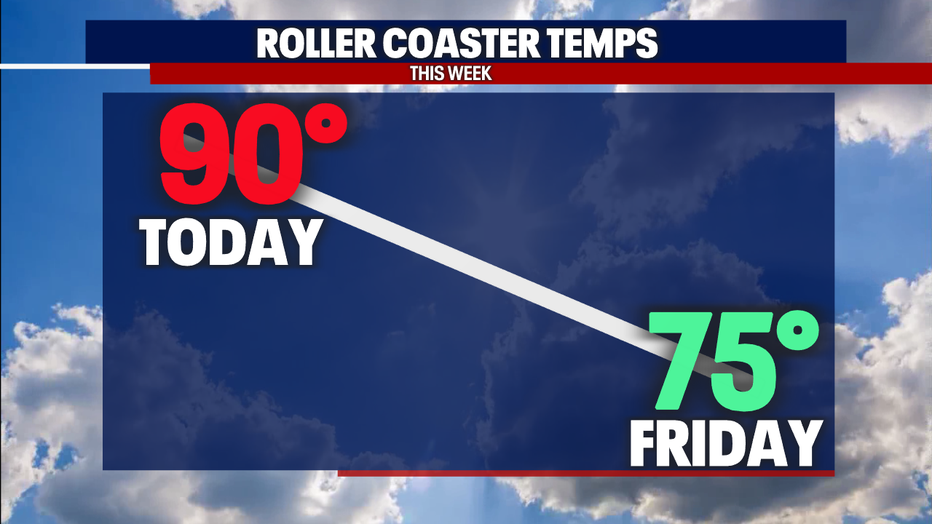
Highs today will soar to about 90 degrees in Seattle. Temps tomorrow plunge to the mid 70s.
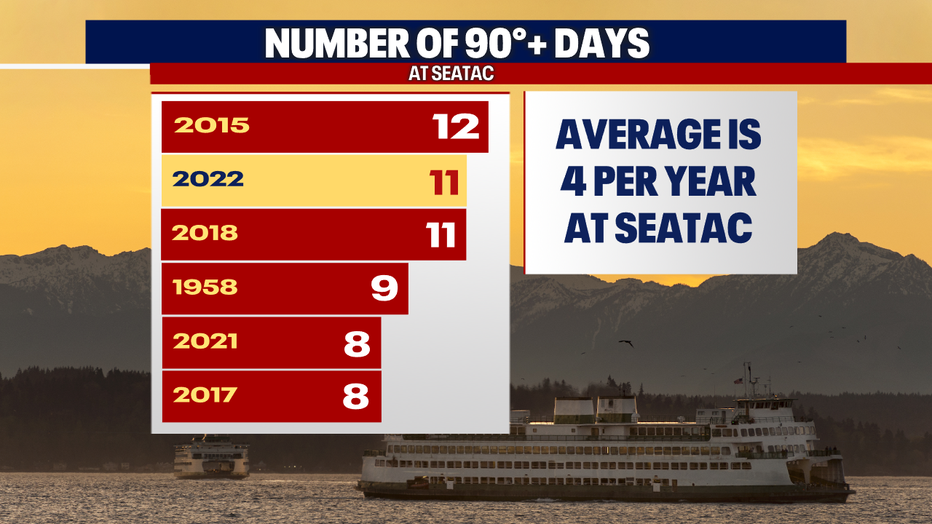
If Sea-Tac Airport hits 90 today, we'll tie the all-time record for the most days 90 degrees or warmer in one year. The current record was set in 2015 with 12 days 90 degrees or above. So far this year, we've had eleven days. The average is just four days a year!
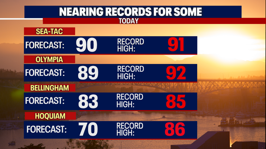
Highs today at Sea-Tac, Olympia, and Bellingham will also approach records for daily highs. Hoquiam won't even get close. Check it out:
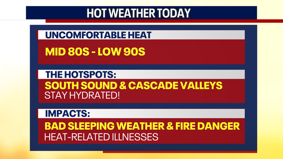
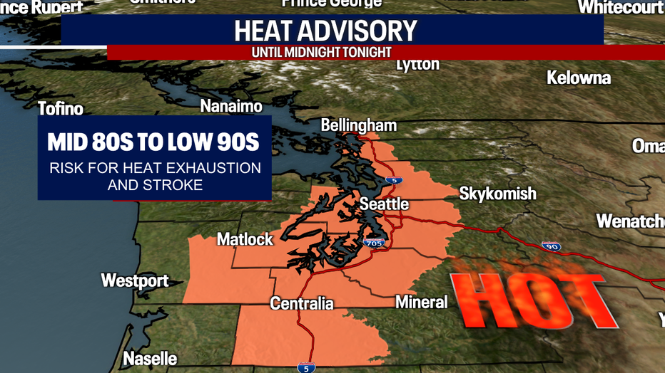
This afternoon, the hottest temps will be in Central and South Puget Sound. Some of the Cascade valleys will get quite toasty, too. Stay hydrated and take extra care of your kids, seniors and pets today. If you don't have air-conditioning at home, consider heading to a local cooling center or a mall, movie theater, or library with A/C.
Fire danger is elevated. There's also a moderate risk for heat-related illnesses. Due to this, the National Weather Service in Seattle is continuing a Heat Advisory for Puget Sound through midnight tonight.
There's also a slight chance for thunderstorms today in Eastern Washington and across the Cascades. We'll have to watch for new wildfires caused by lightning.

Temps drop noticeably on Friday due to a strengthening westerly flow. This will knock down highs to the mid 70s. Saturday stays cool as well. There will be more clouds than sunshine Friday and Saturday. A few sprinkles are even possible those two days.
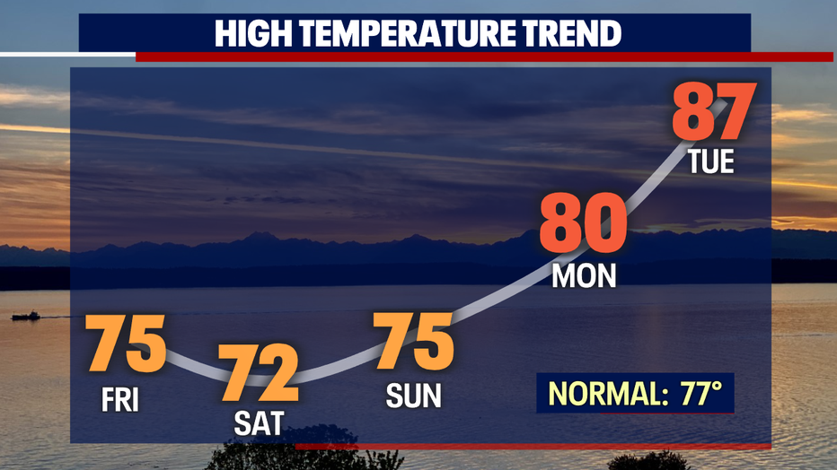
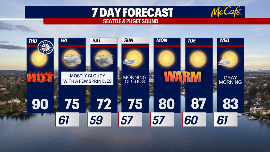
The month of August ends rather hot with highs in the 80s. Quite a contrast to our chilly and wet spring!
Stay cool and take good care today.
Sincerely,
Meteorologist Abby Acone
Follow me on Twitter @abbyacone, Instagram @abbyaconewx, TikTok @abbyaconetv and Facebook (Meteorologist Abby Acone)