

Beautiful weather for the Northwest, massive hurricane making landfall in the Southeast
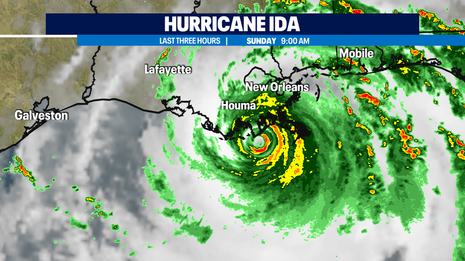
Seattle - Hurricane Ida is making landfall on Grand Isle on the Gulf Coast of Louisiana. Ida is a strong Category 4 hurricane with maximum sustained winds of 150 mph. Today is the anniversary of the day Hurricane Katrina hit New Orleans 16 years ago. Katrina was a Category 3 hurricane. It was the unusual wind flow from Katrina, strong winds on the northwest side of the storm that came from the north, that caused Lake Pontchartrain to breech its levy and flood New Orleans. Hurricane Ida is a stronger storm, but its track is to the west of where Katrina hit. So, hopefully, damage to the Big Easy will not be as bad as it was on this day in 2005.

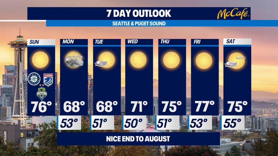
Meanwhile in the upper-left-hand of the country, we are enjoying a beautiful end to August. This afternoon will be sunny with highs in the mid 70s, which is normal for this time of year.

Tomorrow, Monday, will be mostly cloudy with highs in the upper 60s.
Tuesday looks most sunny with highs around 70.
We start September with sunny skies and highs in the low-to-mid 70s. Or as I call it, "Good recess weather!"
The beginning of our Labor Day weekend also looks pleasant with a mix of sun and clouds and highs in the mid 70s on Saturday
Meteorologist M.J. McDermott