As rain, wind and mountain snow decrease we'll see a chance for blue skies again this week!
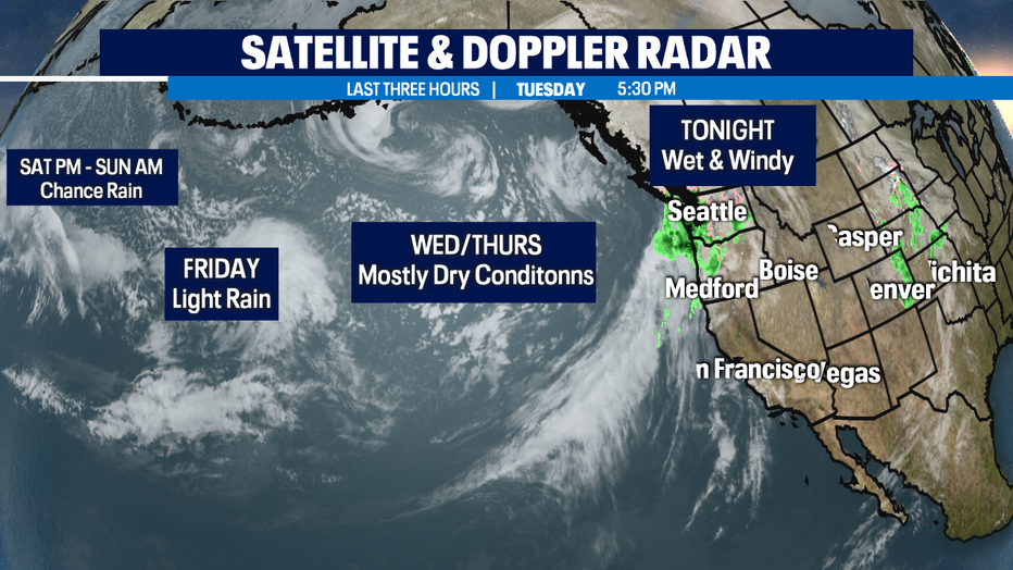
Seattle - Rain, wind, and mountain snow will start to decrease as we push through the overnight hours into early Wedensday morning. That's good news if you're getting a little tired of the sloppy winter conditions. It's also good news for our area rivers, which are very swollen and pushing over their banks.
So, here's the breakdown for the rest of the week. As a front crosses through the region tonight into tomorrow, it will start to fall apart. This will allow some clearing and drying, which is much needed everywhere!
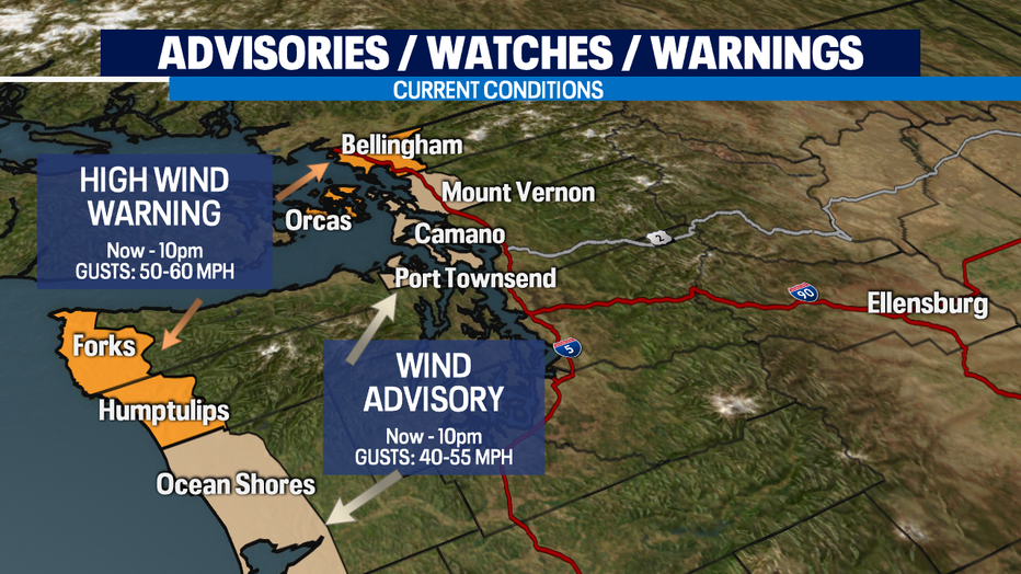
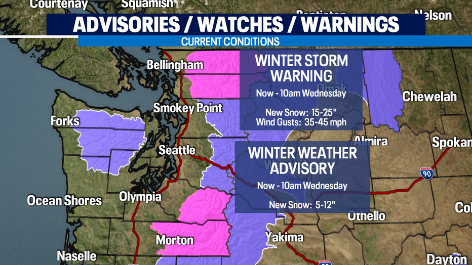
As winds decrease our High Wind Warning and Wind Advisory will expire around 10pm, but we expect breezy conditions to continue overnight for the Northern Cascades.
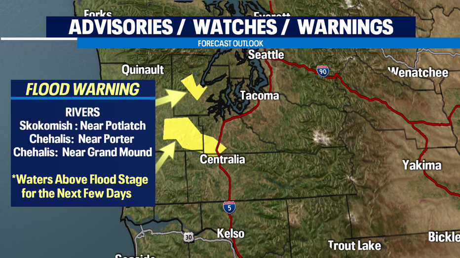
We're starting to sound like a broken record too with all the lowland rain and mountain snow falling our region is under a decent amount of stress when it comes to our area rivers. Several rivers are very swollen and are at or above flood levels. Water is running over banks of not only rivers, but streams as well. We're seeing localized ponding on residential roadways too! Be safe and know your surroundings, especially when traveling to or through places you are not familiar with.
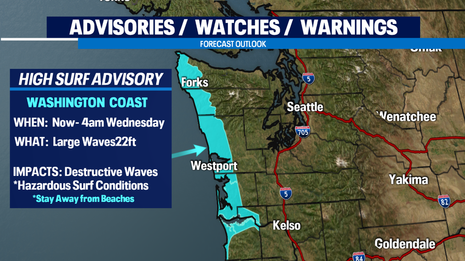
As we monitor the flood threat, we also are keeping an eye on the sea waters off the coast. There is a High Surf Advisory in effect through early Wednesday for very dangerous breaker waves. Stay away from the surf zone along the Washington Coast. We expect waves to cause hazardous conditions along with beach erosion.
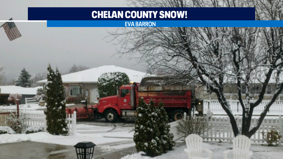
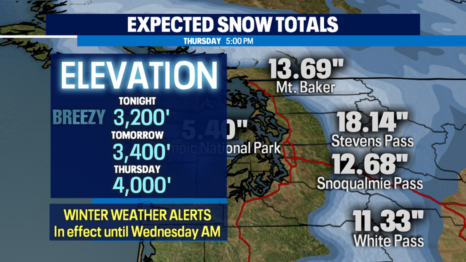
Now to the mountains where we continue to see snow pile up! Over the next 12 hours we could see 6-12" of snow fall. As the storm tapers off Wednesday morning conditions across the pass will improve. Our snow levels will hang between 3,000-4,000ft. Thursday will see a brief ridge of high-pressure move in giving way to some clearing. At this point models are not in alliance about Friday and the weekend. Stay tuned!
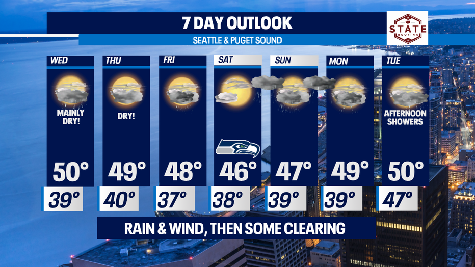
We finally get to talk about some dry days for the lowlands. Seems like we haven't had a good 24-hour spell in a while. This week Wednesday should be mostly dry with just a few showers for SW WA and along the SW and Central Coast. Skies will remain mostly cloudy, but some areas will see a little more clearing than others. Thursday looks even better! We'll stay dry with partly to mostly cloudy skies. Highs remain slightly above the norm, landing in the upper 40s to near 50. Overnight lows fall into the upper 30s to low 40s.
Rain returns late Thursday into Friday with a break Saturday. Showers push back inland just after dinner time Saturday night. Those showers should wrap up just in enough time for Seahawks Sunday! The Hawks host the Rams at 1:40pm from Lumen Field. Catch all the game day action on #Q13Fox #GoHawks
More rain for Monday and Tuesday next week! Have a great night! ~Erin
______________________________________________
- Erin Mayovsky, Q13 Forecaster
Twitter: @ErinMayovsky
FaceBook: /ErinMayovsky
Instagram: @ErinMayovsky
______________________________________________