

Amazing April days ahead
SEATTLE - After a beautiful Monday, we're going to see more sunshine and even warmer temperatures on Tuesday.
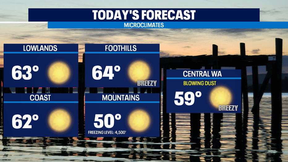
We'll again start out chilly, but much warmer than yesterday AM. Highs today will be about 5-8 degrees warmer than Monday. Most of us will end up in the 60-65 range in Western WA. The average high temp for this part of spring is 58 degrees. Blowing dust will be in issue in localized areas in Central & Eastern WA.
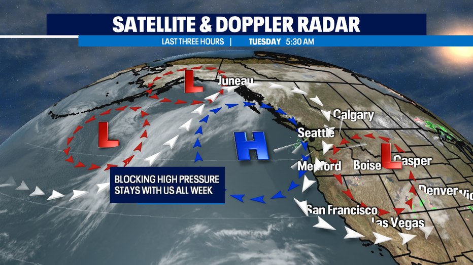
High pressure ridge sitting over the Pacific NW is a particular kind of high pressure ridge called an Omega Block. (For fellow and aspiring weather nerds alike: it’s characterized by a high pressure ridge sandwiched between two cut-off lows.)
It tends to drive in a strong N/NE wind pattern and stay put for awhile, like a whole week or more. So, this beautiful stretch of weather will be able to deliver the longest dry streak with warmest weather pattern we've seen so far in 2021. It's called an Omega Block because the jet stream (shown here with the white arrows) around the Low and High pressure resembles the horseshow shape of the Greek letter 'omega'.
As we get into the late part of the week, high pressure will be right over us and downslope warming Cascadia winds will help jump our temperatures into the 70s for the first time this year for 3/4 days. The Sounders home opener will be balmy and pleasant on Friday evening. Our likely warmest day is Saturday with highs in the mid 70s. The last time we hit 70+ at SeaTac was October 6th.
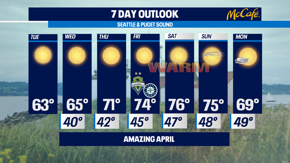
At this point it looks like the ridge pattern features break down by the end of the weekend which will mean incoming clouds and cooler temperatures back into 60s for the beginning of next week. But still no rain drops in sight. -Tim Joyce
Q13 WEATHER RESOURCES:
DOWNLOAD: Q13 Weather and News Apps
WATCH: Forecast and Radar
READ: Closures and Delays
CHECK: Latest Weather Alerts and Live Traffic Map
INTERACT: Submit your Weather Photo
FOLLOW: Lisa Villegas, MJ McDermott, Tim Joyce, Erin Mayovsky and Grace Lim