After a few sprinkles, summer sunshine returns with warmer highs!
SEATTLE - Ready to hang in the 80s again? This week is going to be nice for sure. Summer will live on this first week of September. In fact, even the holiday weekend is looking nice at this point.
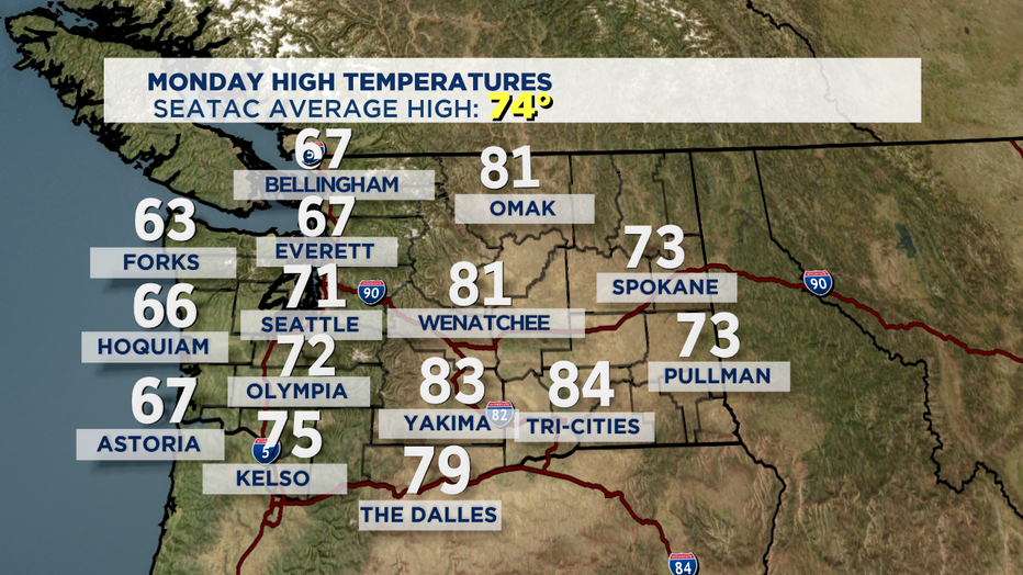
High temps today were cool, only in the mid to upper 60s along the coast and north Sound, while Seattle south saw highs in the mid 70s along with the foothills too.
Expect unseasonably warm temperatures this week all thanks to high pressure. A strong ridge will build in driving our sunny and dry forecast. So, if you were looking forward to cooling off and feeling a little more like fall you'll have to wait a bit longer as summer lives on around the Northwest.
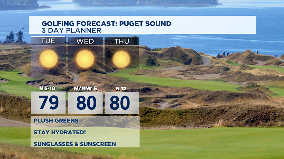
Tuesday, starts off nice right out of the gate for Puget Sound. Everett north to the border might see some morning clouds before clearing out. Highs will climb into the mid to upper 70s with some 80s south possible.
We'll repeat those conditions through the week with highs reaching 80 by Wednesday with even warmer temperatures Thursday with a chance of some low lying fog for the usual areas. Overnights will remain slightly above average in the upper 50s to low 60s.
By the weekend highs could jump even more as offshore winds and high pressure continue to donminate our forecast. Some of us to the south could even see some low 90s again! Yes low 90s! HOT! Seattle northward look for upper 80s. WARM! Stay tuned....
Have a great night! ~Erin
________________________________
- Erin Mayovsky, Q13 Forecaster
Twitter: @ErinMayovsky
FB: /ErinMayovsky
Instagram: @ErinMayovsky
________________________________