Active weather for Western Washington, Cascades through weekend
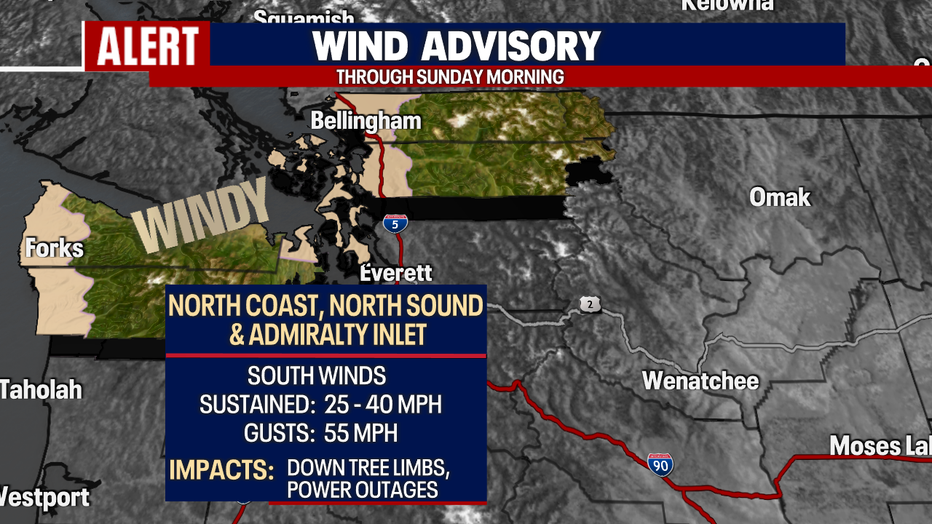
SEATTLE - Overnight will be gusty for many, especially along the north coast, islands, and North Sound. We expect peak winds, 35-55 mph, through the middle of the night before relaxing by sunrise.
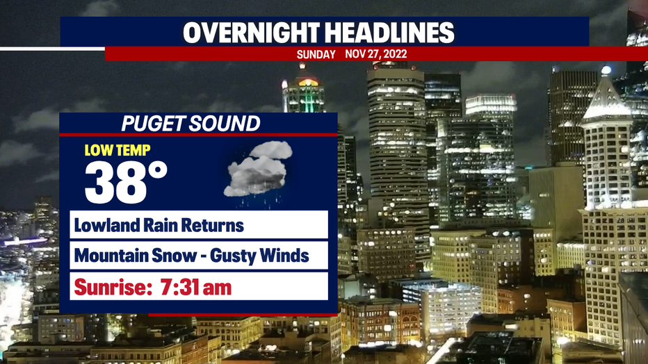
A "Wind Advisory" remains active through early Sunday morning. We may see down tree limbs and some areas of power outages.
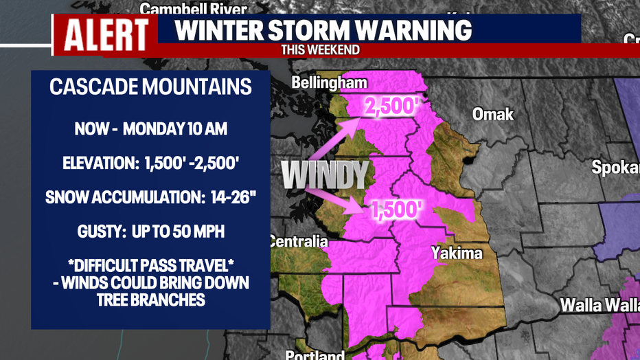
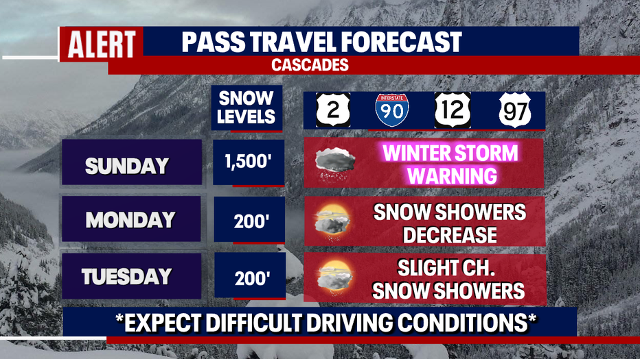
Holiday and Apple Cup travelers will have a difficult time crossing the Cascades Sunday as a "Winter Storm Warning" is in effect through early Monday morning. Please know the roads before you make the trip.
We expect another 5-10" of snow above 1,500' for the Central and South Cascades with even more over the Northern Cascades above 2,500' through Sunday. And there is the potential for thunderstorms to fire up making the situation even more difficult for driving.
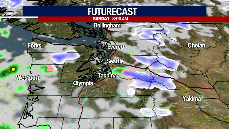
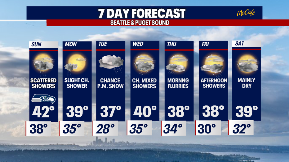
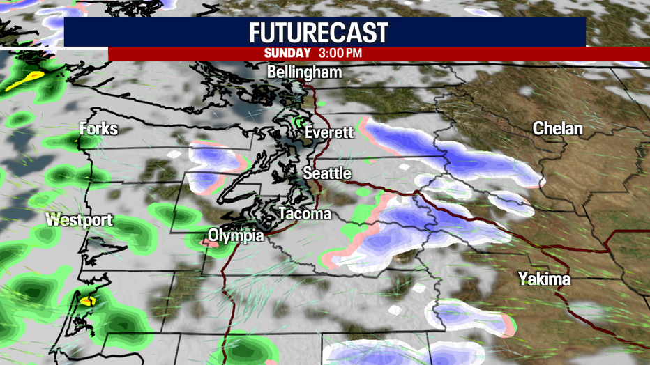
Puget Sound should see quieter day than the mountains with scattered showers and dry periods. Highs will only top out in the low 40s.
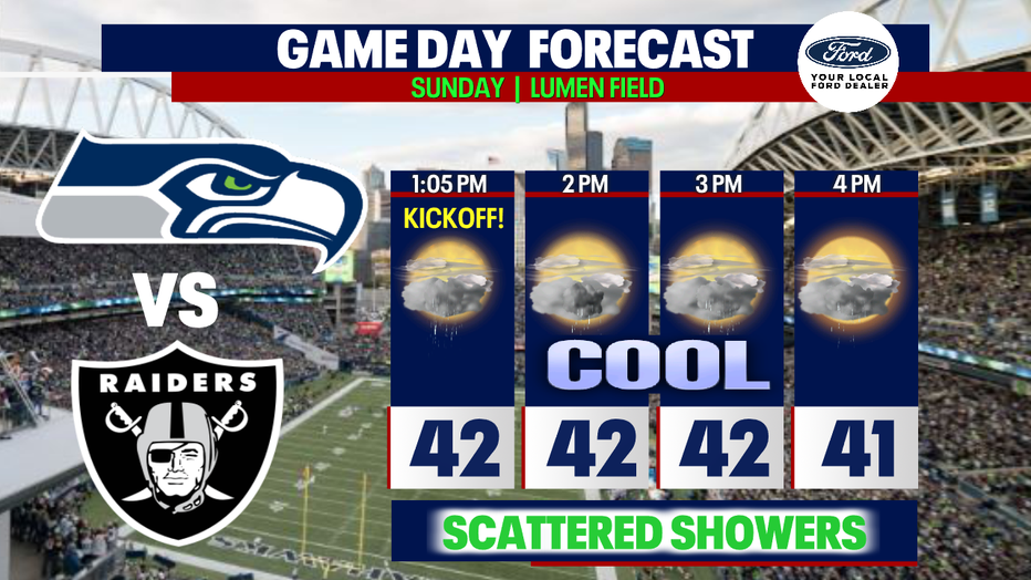
Plan to dress warm for the Seahawks game at Lumen Field. Kick off set for 1:05pm with the Raiders in town. #GoHawks
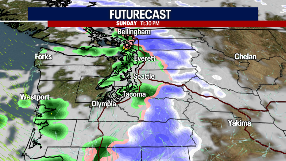
Snow will start to let up some Sunday afternoon, but it does pick up again late Sunday night.
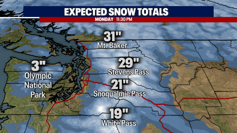
Here's a look at our forecast snow totals for the Cascades through Monday night.
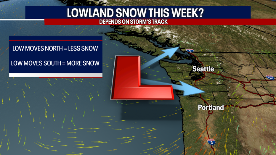
With cold air invading the Pacific Northwest next week along with lowering snow levels we are watching the chance for the lowland snow. This of course all depends on timing and which way the storm track rides into the region.
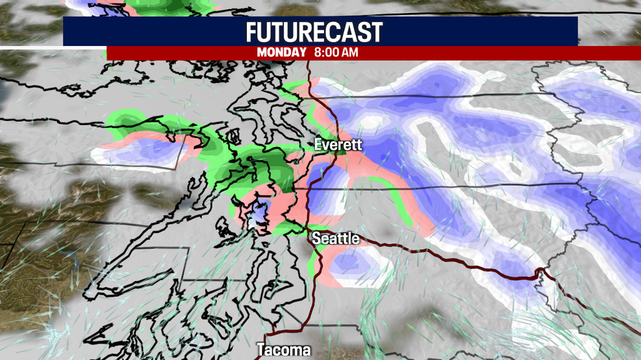
We are watching for isolated pockets of snow showers early Monday before lingering moisture dries up.
The best shot for our first lowland snow of the season is Tuesday into Wednesday.
At this point we are still several days out and there is plenty of time for the forecast to shift some. This event is all about timing folks—we're watching the storm track closely, along with temperatures, precipitation, snow levels, etc. Again, if the low shifts and digs farther south we may see a more widespread snow situation unfold giving us the chance for some accumulation, possibly trace to a few inches. But if that low moves more north less snow activity will happen. Stay tuned!
The rest of the week will remain unsettled and cold with chances for passing showers each day. Enjoy!
Have a great rest of the weekend everyone! ~Erin Mayovsky, FOX 13 Forecast