

Abundant April sunshine delivering big weekend warm up
Seattle - Happy pre-Friday! If you're keeping count, today will be our fifth dry day in our streak of nice weather. Many more are ahead.
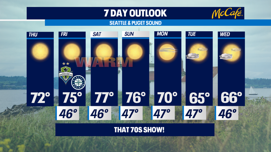
So far in 2021 we've only been managed to get six of these in a row in March-- but this trend lasts into next week. Today we'll also soar our temps to well above the normal of 58. 70s anyone? Olympia hit that yesterday. Many more of us experience what we're calling "That 70s Show" today. We haven't seen 70+ at SeaTac since the 6th of October 2020.
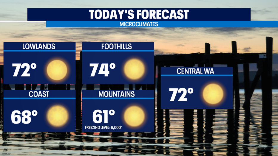
In a typical year, we usually hit 70 for the first time by April 15th and so back on track today. We peak on Fri/Sat with highs in the mid to upper 70s-- a few spots might hit 80. That's warm for April. The official record for SeaTac on Saturday is 80; the record for Sunday is 89. Those records will likely stay put though.
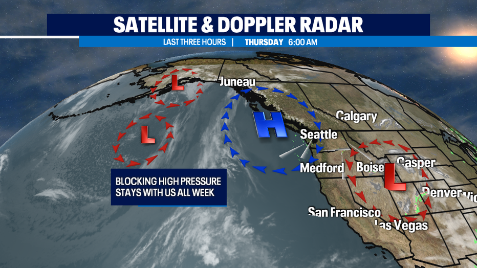
Long range, the blocking high pressure ridge that's been with us all week will break down starting Sun/Mon. It doesn't look like a rapid pattern shift. We gradually cool down back to the pleasant 60s and we'll see more marine influenced air which will mean more partly sunny until we get a front moving in late week to deliver some spring showers, clouds, and back towards the seasonal norms just below 60.
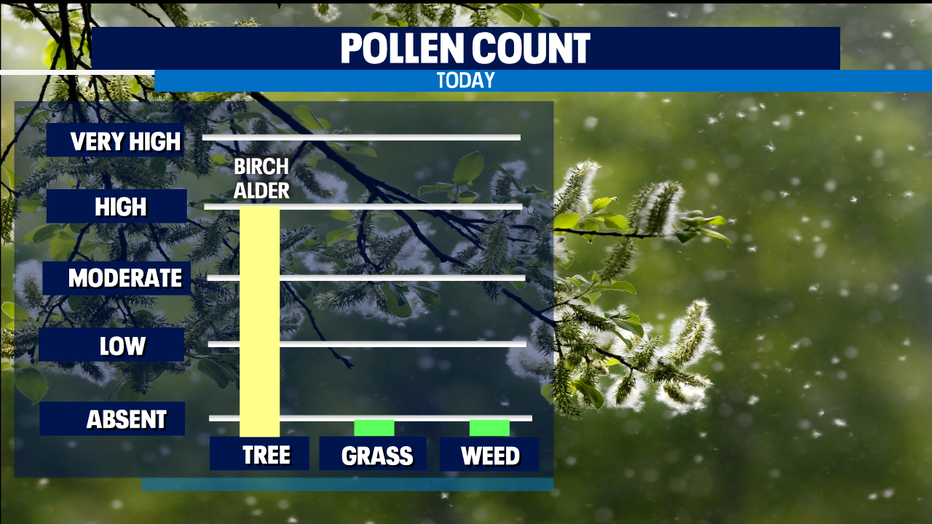
The biggest weather related issues are two fold avalanches and allergies. For allergies, expect High to Very High range for tree pollen. April is usually when tree pollen declines and weed/grass pollen starts showing up in air samples-- but trees haven't seen many warm days this spring at all. So expect higher pollen counts until rain returns.
The other issue is the decreasing stability of our snow pack. We saw PLENTY of snow this winter for summer water needs, but higher terrain and backcountry areas currently have Moderate avalanche risk. That will increase as temps warm through the weekend. Be avalanche aware and choose your high terrain hikes accordingly. - Tim Joyce