

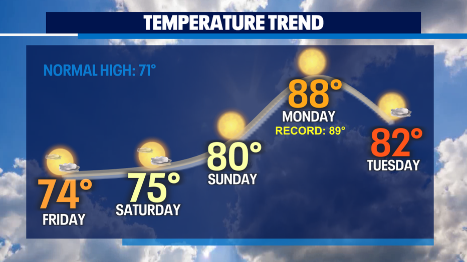
Above normal temperatures continue into the weekend, record highs possible Monday
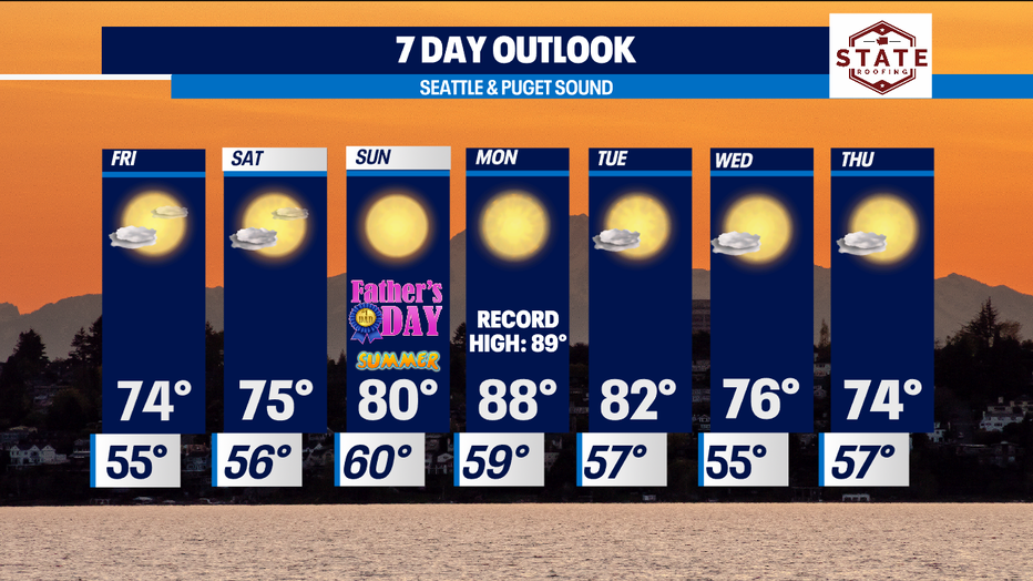
SEATTLE - The big weather story is the summer heat that is on the way! Temperatures are going to break into the 80s by Father's Day on Sunday and close to 90° by Monday, the first full day of summer. Temperatures are expected to hit 88° for Monday's high in Seattle, which is only 1° shy of the record!
SW Interior areas will likely see highs in the 90s. This heat coincides with the Summer Solstice and the longest days of the year at 16 hours of daylight, so it is very important to take precautions to stay cool such as being hydrated and checking your car for children and pets. Tuesday will be warm as well with afternoon highs in the lower 80s.
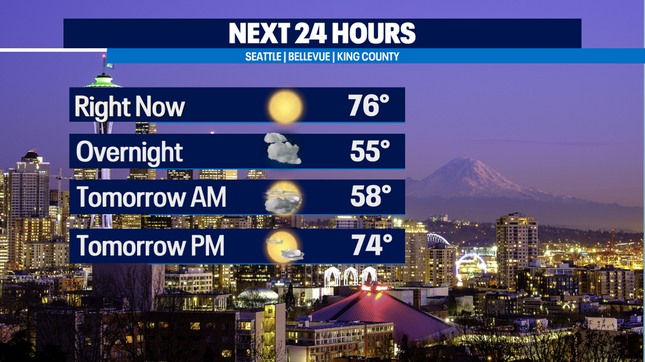
In the near term, after a toasty day today and highs topping off at 77° at SeaTac, we are slowly cooling off. A system offshore will increase clouds this evening and tonight and lows will be in the low to mid-50s. Friday morning starts off with clouds, but they will gradually decrease throughout the day making way for sunshine and highs around 74°.
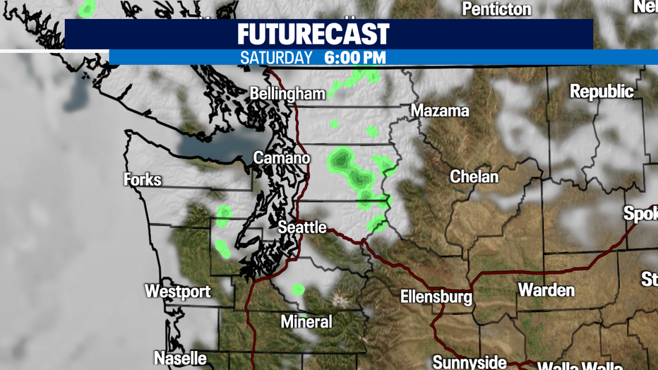
On Saturday, a disturbance will ride around the ridge of high pressure and we may see some sprinkles and more cloud cover. It won't be anything impactful so keep your plans! Highs will be in the mid-70s.
Flow becomes offshore Sunday through Tuesday which is why temperatures are going to soar into the 80s! Onshore flow establishes itself by Wednesday and Thursday, keeping our highs a lot more comfortable in the mid to upper 70s.
Have a great day!
Stay connected with Q13 News on all platforms:
DOWNLOAD: Q13 News and Weather Apps
WATCH: Q13 News Live
SUBSCRIBE: Q13 FOX on YouTube
FOLLOW: Facebook | Twitter | Instagram