Seattle weather: A sunny Sunday with highs in the low 70s, then cooling down into the work week
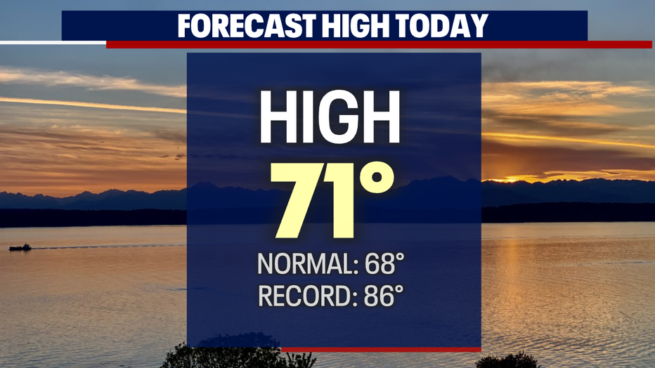
SEATTLE - Get out and enjoy this sunny Sunday with highs forecast into the low 70s for the first time this month.
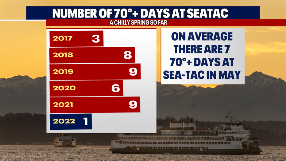
Normally May sees on average 7+ days at or above 70. So far this year we have only seen one 70+ day and that came back on April 7th (73).
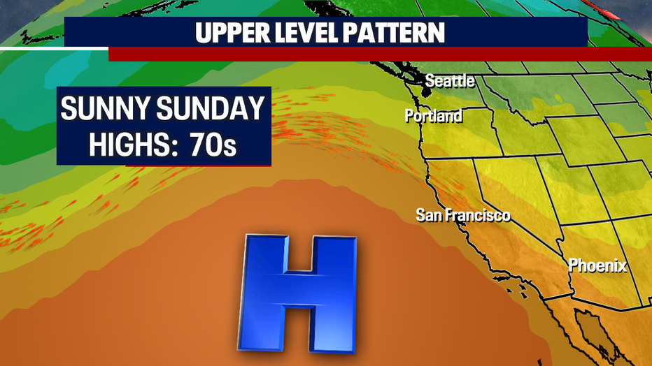
Our late Spring warmth courtesy high pressure, but don't get used to the 70s because they are short-lived! Our high skirts off to the east and opens the door for onshore flow to return with clouds building back in throughout the workweek. Highs will cool again too.
Here's a peek at today's forecast highs around the region. Most folks will climb to near 70 except for the North Sound where temps will only land in the upper 60s near normal.

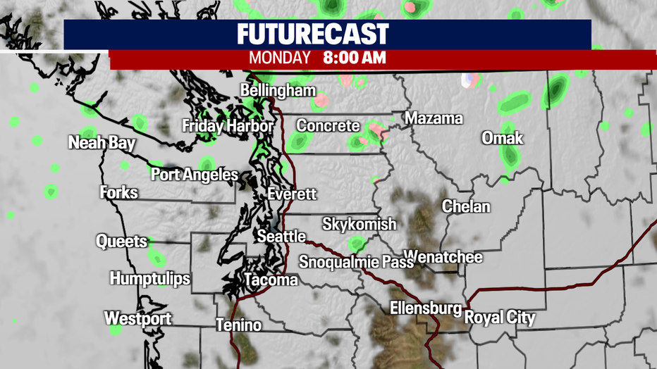
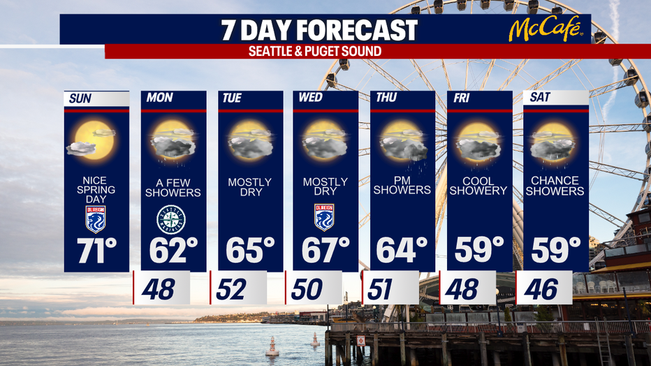
Mostly cloudy skies push in late today and will hang with us into the Monday morning commute. A few light showers will pop up through the Islands and North Sound, but nothing too heavy. Highs drop nearly 10 degrees back into the low 60s.
Tuesday we'll warm into the mid 60s under mostly cloudy skies. We should stay mainly dry through Thursday afternoon, but shower return by the evening commute. Highs Thursday land close to average at 67. Cool and showery conditions last through the end of the workweek and roll into the weekend.
At this point the weekend looks more like the start of Spring with temperatures dropping into the upper 50s with a chance of shower. Brr! Enjoy!
Have a great day all! ~Erin Mayovsky, FOX 13 Forecaster
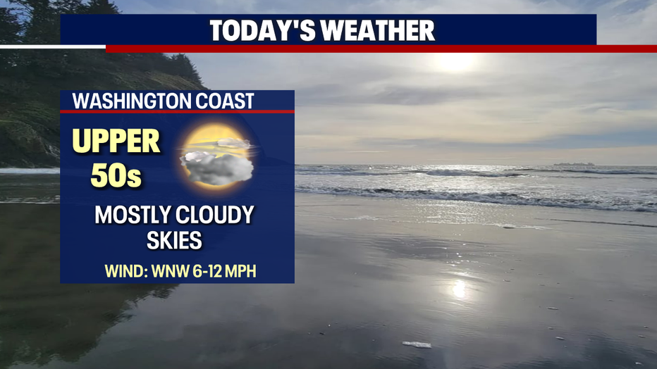
*Beach Forecast
*Mountain Forecast

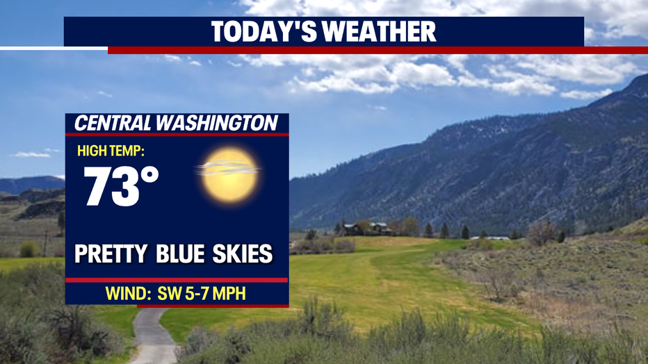
*Central WA Forecast