Seattle weather: Quick round of showers, then slowly warming back to summer temps
SEATTLE - A quick moving front swings through the region tonight into tomorrow dropping showers. The bulk of this system sends rain over the North Sound, but we do expect a few showers for folks south of Seattle and over the mountains as well.
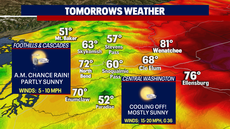
Highs Wednesday only climb into the mid 70s at SeaTac. To the north highs ran cooler for places like Bellingham, who only hit 68.
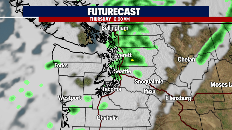
As a cold front moves across the region rain will be heaviest for Skagit and Whatcom Counties, while others see light showers. Rain first hits near midnight with a line stretching out from the coast near Westport to Whatcom County to the north.
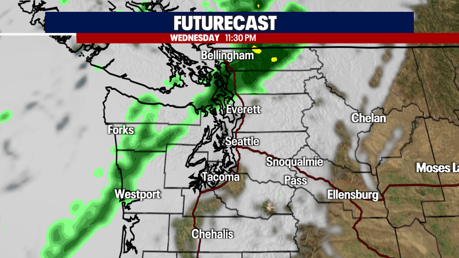
As the band falls apart, showers fizzle out at the coast first with the majority of the rain Seattle north across the Canadian border by 6 a.m.
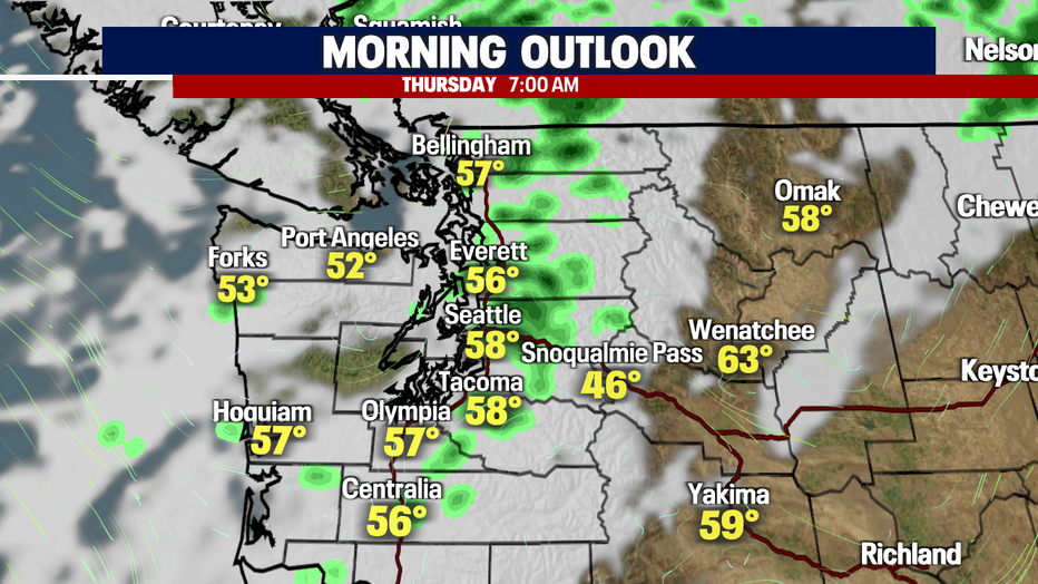
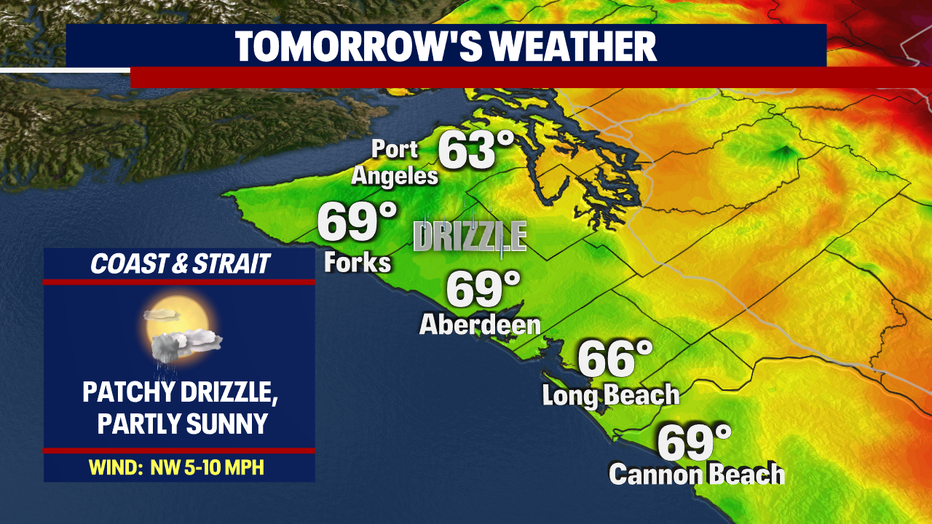
Temperatures out of the gate tomorrow start near average in the upper 50s. We expect a few light showers during the morning commute as far south as Tacoma.
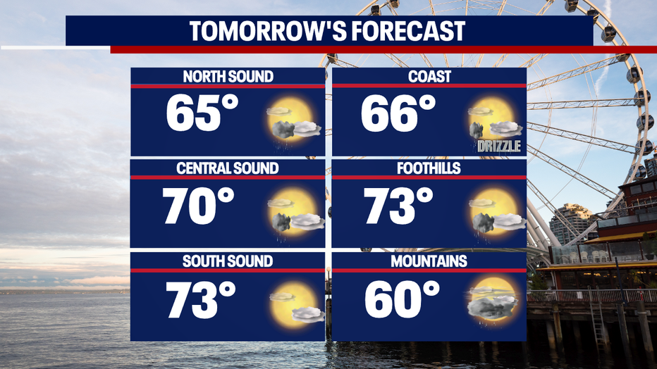
By midday Thursday skies start to clear for a partly sunny afternoon. Expect highs much cooler tomorrow with most of us in the mid to upper 60s with low 70 Seattle south.
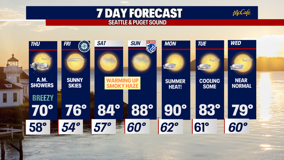
The extended forecast has us heating back up again as ridge builds into the region. We may flirt with 90 Sunday into Monday. Stay tuned!
*Beach Forecast
*Foothills, Mountains, & Eastern WA Forecast