

Active Friday morning weather; improvements for the weekend
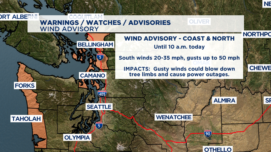
SEATTLE - A cold front is slicing through the region this morning with rain, heavy at times, and gusty winds. There is a Wind Advisory posted now until 10 a.m. for the Washington Coast and the North Interior - areas in orange on this map. With gusts up to 50 mph we could have tree limbs down over power lines and power outages.
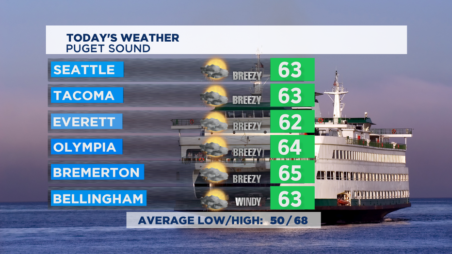
This afternoon, steady rain tapers off to showers and sun breaks, and the wind will calm down as well. It's also cooler than normal, with highs in the low 60s. Normal right now is 68 degrees.
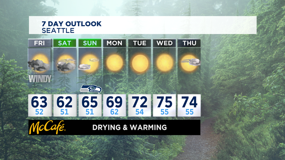
Tomorrow will be showery with highs in the low 60s.
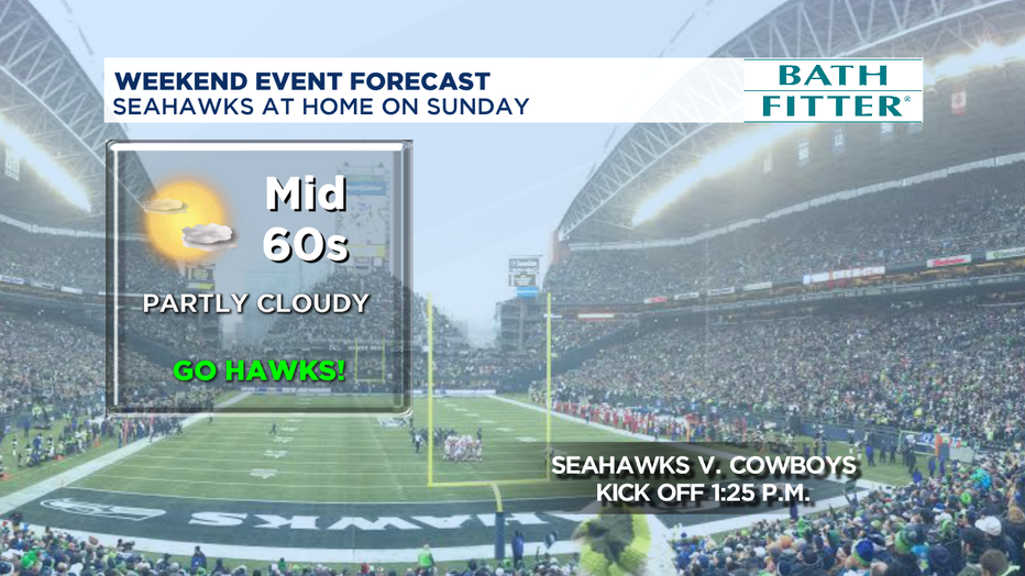
Sunday looks dry with partly sunny skies and highs in the mid 60s. Great for the Seahawks!
Next week we go back to summery conditions with sunny skies and highs in the low-to-mid 70s!
Have a good weekend! Go Hawks!
Meteorologist M.J. McDermott